Here’s a list (not complete) of the features:
Compatibility:
- Works with Unity 3.x, 4.x and Unity 5 ready.
- Works with Unity Free and Pro.
- Works with Windows and Mac.
- Works in runtime in a Build.
- Imports from World Machine and other outside Unity terrain tools.
Updates:
- Built in version updater.
Included Tools:
- Terrains Splitter. Split terrain/s into more terrail tiles.
- Export Unity terrains to meshes.
- Smooth heightmap terrains.
- Measure terrains.
- Filter Images (e.g. Satelite) on colors and export its texture.
- Create Heightmap/Pattern Textures.
User Interface:
- Fast, flexible and colorful user interface.
- Embedded video tutorials
- Multi-Threading, while generating terrains it’s still possible to continue working in Unity.
- Auto Generation, see changes you make immediately in the Scene view.
- Activation/Deactivation for each group/component/output.
- Edit Layer and Description names.
- Save/Load whole projects, layer groups, layers, color ranges and generated textures.
- Copy/Paste/Swap any component within the hierarchy.
- Undo/Redo for deleted components.
- Import/Export generated output to Texture (Normalmap, splatmap, colormap and heightmap).
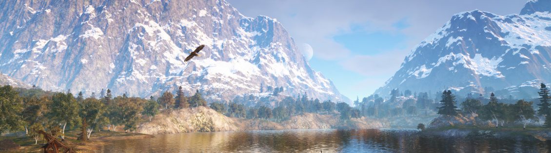
Terrains:
- Supports Multiple Terrains (unlimited) which can be created automatically.
- Import/Export .Raw 16bit heightmap files.
- Import/Export splatmaps.
- Use large .Raw files with resolution >4096 and spread them over multiple terrains.
- Convert meshes to Unity terrain.
- Convert Unity terrain to meshes.
- Slice Terrains into 4 terrains each, keeping all data.
- Stitch Terrains for non fitting heightmaps.
- Supports all resolutions. Can convert resolutions to lower or higher during any stage.
- Automatically arrange positions of multiple terrain to one big tile, or re-arrange when the size changes, with one click.
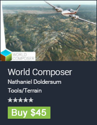
- Use real World data heightmaps.
- Use real World satelite images.
- Automatically seach and add terrains from the Scene with one click.
- Fast resolution/size/splat/trees/grass and detail assignment and apply to multiple terrains.
- Unity terrain parameters multi terrain edit.
- Create a custom square area for each terrain, or create one square world area over multiple terrains.
- Control the resolutions of each terrain.
- Option to automatically stitch terrain borders.
- Makes seamless tiles.
- Adjustable view and terrain settings for runtime.
- Reset buttons for heightmap,splatmap,trees,grass,detailmap and placed objects.
- Active/Deactive each terrain.
Create/Export:
- Color maps/normal maps/splatmaps/raw heightmaps in a few clicks.
- Tree maps and grass maps.
- Multi 3dmodel mesh top view images.
- Pattern images.
- Perlin images.
Input/Ouput options:
- Create unlimited amout of layers.
- Create unlimited amount of filters and subfilters within each layer.
- Terrain input parameters like height, steepness and normal.
- Input from images, create rules on color and color ranges. Options like scale, offset, rotation.
- Automatically stretch images and raw heightmaps over terrain/area/multi terrains.
- Use filter and curve settings to create any kind of blending, it works on all layer outputs.
- Add unlimited amout of curves to a filter, like normal curves, random curves and perlin curves.
Layer outputs:
- Heightmap.
- Heightmap generation with unlimited filters,subfilters and curves.
- Assign raw heightmap files directly to filters and subfilters. Can convert resolutions, spread over terrain/area/multi terrain. Apply any curve to change heightmap output.
- Heightmap editing with images as input. For example to create rivers, curved out roads, bunkers for golve course, etc.
- Colormap.
- Create unlimited amout of colors.
- Load/Save color groups.
- Unlimited filters, subfilters and curves for picking color and its alpha.
- Control texture density of each color with each layer.
- Splatmap.
- Adjustable mix rate for transitioning from one splat to the other.
- Unlimited filters, subfilters and curves for picking splat and its alpha.
- Control texture density of each splat whith each layer.
- Tree.
- Tree placement from image or any filter option, specifying scale range, different colors, distance between each tree, etc etc
- Unlimited filters for selecting tree scale, and subfilters for selecting tree color.
- Make tree colors from an image.
- Unlimited filters, subfilters and curves for picking tree and its density.
- Grass/Detail.
- Adjustable mix rate for transitioning from one grass kind to the other.
- Unlimited filters,subfilters and curves for picking grass and its density.
- Control grass density of each kind with each layer.
- Object.
- Object placement from image or any filter option, specifying scale range, rotation range, position range, different materials, distance between each object, rotation map,etc, etc.
- Automatic parenting with placing objects, automatic combine children meshes for optimum performance.
- Multi-level output, create layers inside each object to unlimited levels with its own area.
There’s many more features and soon I will add more to the list.